
A.A. van de Pas1*, S.A.J. Tas.1 , N. Tashin1, A.J.F. Hoitink1
1Hydrology and Environmental Hydraulics Group, Wageningen University and Research, The Netherlands
* Corresponding author: ariane.vandepas@wur.nl
Introduction
Water levels near the equator are often influenced by monsoonal winds. These winds have a strong seasonality as they blow in opposite directions during Summer and Winter. This can create a seasonal wind setup of up to 30 cm. The Bay of Bengal has an ideal geometry for a high wind setup due to its funnel shape. This wind setup is often overlooked when modelling this area, which potentially underestimates the actual water levels, which is especially dangerous when flood risks are investigated. However, this wind setup is not the only factor influencing the water levels near the Bengal coast: tidal dynamics and river discharge also have a substantial effect. This interaction between wind setup, tides and discharge is complex and has only been investigated on shorter time scales, typically in relation to storm surges, but on a seasonal timescale these interactions have not been investigated in detail yet.
Objective and Methods
The aim of this study is to gain a better understanding of wind-tide-discharge interactions on a seasonal timescale through data analysis of wind and water level datasets in the Bay of Bengal. This is achieved by comparing different wind and water level timeseries and through non-stationary harmonic analysis (Matte et al. 2012). This approach identifies non-linear interactions between discharge, tides and wind, such as the modulating effects of discharge and wind on tidal amplitudes. For instance, when discharge increases, tidal amplitudes generally decrease due to an increase in friction of river flow acting on the tides, while amplitudes increase as the water level increases, due to reduced friction.
Results
Altimetry data reveal a clear yearly water level cycle up to 350 km from the coast with a coastward increasing amplitude to a maximum of 0.25 meter. This pattern coincides with a clear seasonal cycle in the wind data, showing strong southerly winds from April to September and lower northerly wind speeds from November to March, indicating that this seasonal cycle in sea level is caused by wind-setup. In the Lower Meghna, tidal amplitudes decrease with increasing discharge for the most upstream stations, indicating a strong influence of discharge. On the contrary, tidal amplitudes increase with increasing discharge at the coast, suggesting that the river flow effects are not dominant and wind setup may play a role. Overall, there was convincing evidence supporting the influence of wind setup, although separating discharge and wind-induced signals in the river proved to be challenging.
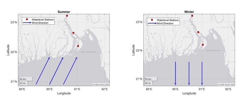
Waterlevel stations in the Lower Meghna and the wind direction in the summer and winter season
References
Matte, P., Jay, D. A., & Zaron, E. D. (2012). Adaptation of Classical Tidal Harmonic Analysis to Nonstationary Tides, with Application to River Tides. Journal Of Atmospheric And Oceanic Technology, 30(3), 569–589. https://doi.org/10.1175/jtech-d-12-00016.1
